


Voting District EF, Transylvania County, North Carolina
About
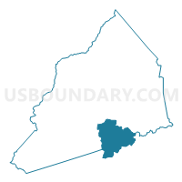
Outline

Summary
| Unique Area Identifier | 641499 |
| Name | Voting District EF |
| County | Transylvania County |
| State | North Carolina |
| Area (square miles) | 23.63 |
| Land Area (square miles) | 23.52 |
| Water Area (square miles) | 0.11 |
| % of Land Area | 99.54 |
| % of Water Area | 0.46 |
| Latitude of the Internal Point | 35.10877780 |
| Longtitude of the Internal Point | -82.75337750 |
Maps


Graphs
Select a template below for downloading or customizing gragh for Voting District EF, Transylvania County, North Carolina


Neighbors
Neighoring Voting District (by Name) Neighboring Voting District on the Map
- Voting District CC, Transylvania County, NC
- Voting District CM, Transylvania County, NC
- Voting District DR, Transylvania County, NC
- Holly Springs Voting District, Pickens County, SC
- Jennings Mill Voting District, Greenville County, SC
- Pumpkintown Voting District, Pickens County, SC
- Voting District RE, Transylvania County, NC
Top 10 Neighboring County Subdivision (by Population) Neighboring County Subdivision on the Map
- Slater-Marietta CCD, Greenville County, SC (4,949)
- Dunns Rock township, Transylvania County, NC (4,877)
- Catheys Creek township, Transylvania County, NC (3,821)
- North Pickens CCD, Pickens County, SC (3,003)
- Eastatoe township, Transylvania County, NC (2,989)
Top 10 Neighboring Unified School District (by Population) Neighboring Unified School District on the Map
- Greenville County School District, SC (466,178)
- Pickens County School District, SC (119,224)
- Transylvania County Schools, NC (33,090)
Top 10 Neighboring State Legislative District Lower Chamber (by Population) Neighboring State Legislative District Lower Chamber on the Map
- State House District 113, NC (75,113)
- State House District 17, SC (37,353)
- State House District 4, SC (33,418)
Top 10 Neighboring State Legislative District Upper Chamber (by Population) Neighboring State Legislative District Upper Chamber on the Map
- State Senate District 50, NC (175,858)
- State Senate District 5, SC (115,205)
- State Senate District 2, SC (97,675)
Top 10 Neighboring 111th Congressional District (by Population) Neighboring 111th Congressional District on the Map
- Congressional District 4, SC (770,226)
- Congressional District 3, SC (722,675)
- Congressional District 11, NC (703,606)
Top 10 Neighboring Census Tract (by Population) Neighboring Census Tract on the Map
- Census Tract 9605, Transylvania County, NC (5,710)
- Census Tract 9604.02, Transylvania County, NC (4,269)
- Census Tract 101, Pickens County, SC (3,003)
- Census Tract 41.02, Greenville County, SC (963)